Items related to Yosemite Se, Ansel Adams Wilderness: Trails Illustrated...
Yosemite Se, Ansel Adams Wilderness: Trails Illustrated National Parks (National Geographic Trails Illustrated Map)
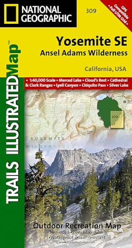

� Waterproof � Tear-Resistant � Topographic Map
Coverage of the Tuolomne Meadows and Hoover Wilderness area of Yosemite National Park includes Ansel Adams Wilderness, Yosemite Wilderness, Mono Basin National Forest Scenic Area, Monroe Hall Research Natural Area, Humbolt - Toiyabe National Forest, Twin Lakes. Includes UTM grids for use with your GPS unit.
Coverage of the Tuolomne Meadows and Hoover Wilderness area of Yosemite National Park includes Ansel Adams Wilderness, Yosemite Wilderness, Mono Basin National Forest Scenic Area, Monroe Hall Research Natural Area, Humbolt - Toiyabe National Forest, Twin Lakes. Includes UTM grids for use with your GPS unit.
- Map Scale = 1:40,000
- Sheet Size = 36" x 22"
- Folded Size = 4" x 7.5"
"synopsis" may belong to another edition of this title.
- PublisherNational Geographic Maps
- Publication date2012
- ISBN 10 1566954134
- ISBN 13 9781566954136
- BindingMap
- Number of pages1
Top Search Results from the AbeBooks Marketplace

Stock Image
Yosemite SE: Ansel Adams Wilderness (National Geographic Trails Illustrated Map)
Published by
National Geographic Maps
(2016)
ISBN 10: 1566954134
ISBN 13: 9781566954136
New
Quantity: 1
Seller:
Rating
Book Description Map. Condition: New. Seller Inventory # DADAX1566954134
Buy New
� 12.60
Convert currency
Stock Image
Yosemite Se, Ansel Adams Wilderness
Published by
National Geographic Maps Division 2012-08-02, Washington, D.C.
(2012)
ISBN 10: 1566954134
ISBN 13: 9781566954136
New
Quantity: 1
Seller:
Rating
Book Description sheet map (folded). Condition: New. Language: ENG. Seller Inventory # 9781566954136
Buy New
� 11.99
Convert currency
Stock Image
Yosemite Se, Ansel Adams Wilderness (Folded)
Published by
National Geographic Maps, Evergreen
(2012)
ISBN 10: 1566954134
ISBN 13: 9781566954136
New
Quantity: 1
Seller:
Rating
Book Description Folded. Condition: new. Folded. National Geographic's Trails Illustrated Maps are the most detailed and up-to-date topographic recreation maps available for US National Parks, National Forests and other popular outdoor recreation areas. A necessity for exploring the outdoors, each map is printed on waterproof, tear-resistant material. They also contain key safety and contact information, GPS and compass coordinates, Leave No Trace ethical guidelines and hundreds of points-of-interest, including scenic viewpoints, campgrounds, boat launches, swimming areas, marine sanctuaries and wildlife refuges. Coverage of the Tuolomne Meadows and Hoover Wilderness area of Yosemite National Park includes Ansel Adams Wilderness, Yosemite Wilderness, Mono Basin National Forest Scenic Area, Monroe Hall Research Natural Area, Humbolt - Toiyabe National Forest, Twin Lakes. Includes UTM grids for use with your GPS unit. Shipping may be from multiple locations in the US or from the UK, depending on stock availability. Seller Inventory # 9781566954136
Buy New
� 16.78
Convert currency
Stock Image
Yosemite SE 309 GPS Ansel Adams Wilderness ng rv wp CA 140 Trails Illustrated National Parks National Geographic Trails Illustrated Map
Published by
National Geographic Maps Division
(2012)
ISBN 10: 1566954134
ISBN 13: 9781566954136
New
Quantity: 1
Seller:
Rating
Book Description UNK. Condition: New. New Book. Shipped from UK. Established seller since 2000. Seller Inventory # EA-9781566954136
Buy New
� 17
Convert currency
Stock Image
Yosemite SE 309 GPS Ansel Adams Wilderness ng rv wp CA 140 Trails Illustrated National Parks National Geographic Trails Illustrated Map
Published by
National Geographic Maps Division
(2012)
ISBN 10: 1566954134
ISBN 13: 9781566954136
New
Quantity: 1
Seller:
Rating
Book Description UNK. Condition: New. New Book. Shipped from UK. Established seller since 2000. Seller Inventory # EA-9781566954136
Buy New
� 11.47
Convert currency
Stock Image
Yosemite Se, Ansel Adams Wilderness (Folded)
Published by
National Geographic Maps, Evergreen
(2012)
ISBN 10: 1566954134
ISBN 13: 9781566954136
New
Quantity: 1
Seller:
Rating
Book Description Folded. Condition: new. Folded. National Geographic's Trails Illustrated Maps are the most detailed and up-to-date topographic recreation maps available for US National Parks, National Forests and other popular outdoor recreation areas. A necessity for exploring the outdoors, each map is printed on waterproof, tear-resistant material. They also contain key safety and contact information, GPS and compass coordinates, Leave No Trace ethical guidelines and hundreds of points-of-interest, including scenic viewpoints, campgrounds, boat launches, swimming areas, marine sanctuaries and wildlife refuges. Coverage of the Tuolomne Meadows and Hoover Wilderness area of Yosemite National Park includes Ansel Adams Wilderness, Yosemite Wilderness, Mono Basin National Forest Scenic Area, Monroe Hall Research Natural Area, Humbolt - Toiyabe National Forest, Twin Lakes. Includes UTM grids for use with your GPS unit. Shipping may be from our Sydney, NSW warehouse or from our UK or US warehouse, depending on stock availability. Seller Inventory # 9781566954136
Buy New
� 21.08
Convert currency
Stock Image
Yosemite Se, Ansel Adams Wilderness (Folded)
Published by
National Geographic Maps, Evergreen
(2012)
ISBN 10: 1566954134
ISBN 13: 9781566954136
New
Quantity: 1
Seller:
Rating
Book Description Folded. Condition: new. Folded. National Geographic's Trails Illustrated Maps are the most detailed and up-to-date topographic recreation maps available for US National Parks, National Forests and other popular outdoor recreation areas. A necessity for exploring the outdoors, each map is printed on waterproof, tear-resistant material. They also contain key safety and contact information, GPS and compass coordinates, Leave No Trace ethical guidelines and hundreds of points-of-interest, including scenic viewpoints, campgrounds, boat launches, swimming areas, marine sanctuaries and wildlife refuges. Coverage of the Tuolomne Meadows and Hoover Wilderness area of Yosemite National Park includes Ansel Adams Wilderness, Yosemite Wilderness, Mono Basin National Forest Scenic Area, Monroe Hall Research Natural Area, Humbolt - Toiyabe National Forest, Twin Lakes. Includes UTM grids for use with your GPS unit. Shipping may be from our UK warehouse or from our Australian or US warehouses, depending on stock availability. Seller Inventory # 9781566954136
Buy New
� 16.99
Convert currency